Tropical Storm “Rolly” (Goni)
Issued by DOST PAGASA at 05:00 am, November 2, 2020
“ROLLY” CONTINUES TO WEAKENS OVER THE WEST PHILIPPINE SEA.
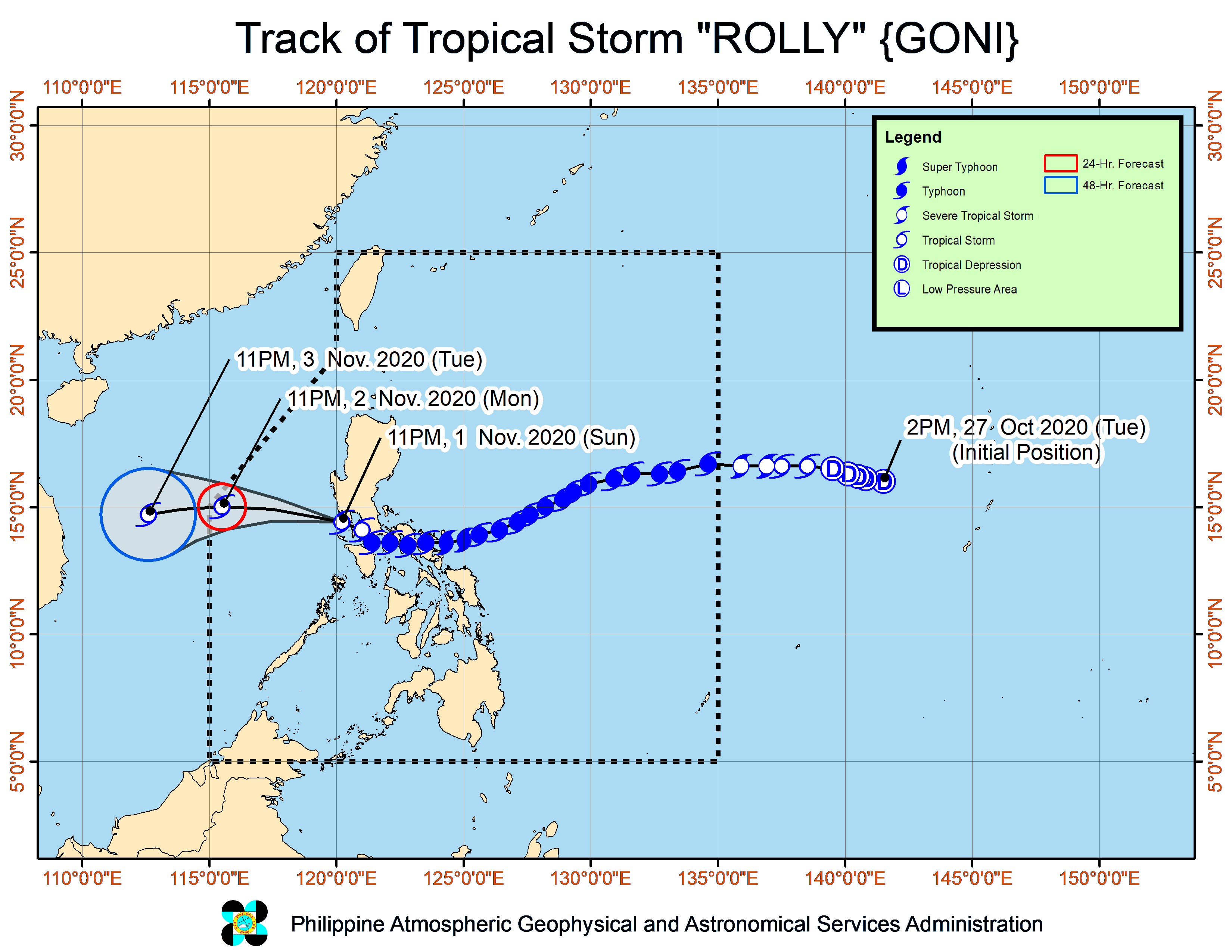
Track and intensity outlook:
On the forecast track, “ROLLY” is expected to exit the Philippine Area of Responsibility (PAR) tomorrow morning. It is forecast to remain as a tropical storm throughout the forecast period. However, there is an increasing likelihood that “ROLLY” will weaken into a tropical depression due to increasingly unfavorable conditions.
Location of Eye/center
At 4:00 AM today, the center of Tropical Storm “ROLLY” was estimated based on all available data at 100 km West Southwest of Subic Bay (14.6 °N, 119.4 °E )
Movement
Moving West Northwestward at 20 km/h
Strength
Maximum sustained winds of 65 km/h near the center and gustiness of up to 80 km/h
Forecast Position
24 Hour(Tomorrow morning): 540 km West of Subic Bay(15.0°N, 115.3°E)
48 Hour(Wednesday morning):805 km West of Central Luzon (OUTSIDE PAR)( 14.7°N, 112.8°E)
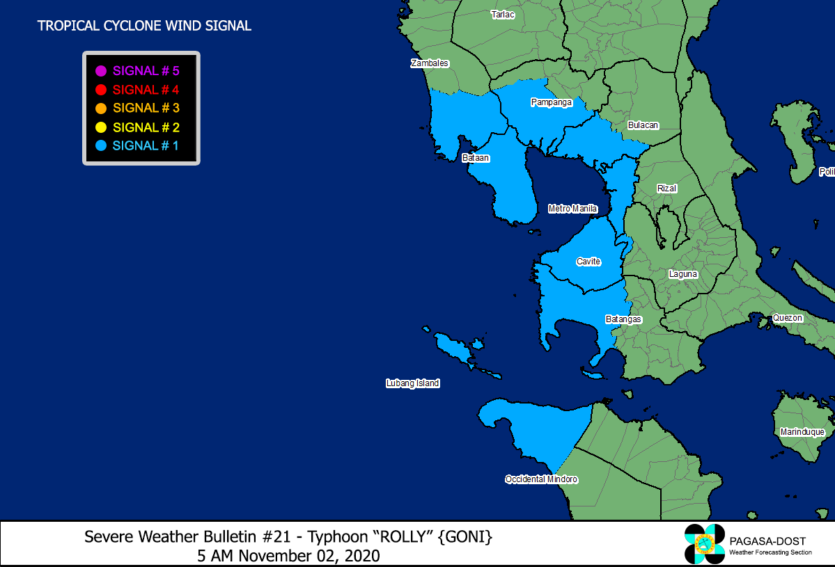
Wind Signal (Areas with TCWS)
Luzon
The northwestern portion of Occidental Mindoro (Paluan, Mamburao, Abra de Ilog) including Lubang Island,
The western portion of Batangas (Tingloy, Mabini, Bauan, San Luis, Taal, Agoncillo, San Nicolas, Santa Teresita, Talisay, Laurel, Lemery, Calaca, Balayan, Calatagan, Tuy, Lian, Nasugbu),
The extreme western portion of Laguna (San Pedro City, Biñan City),
Cavite,
Metro Manila,
The western portion of Bulacan (San Jose del Monte City, Santa Maria, Pandi, Bustos, Baliuag, Marilao, Meycauayan City, Obando, Bocaue, Bulacan, Balagtas, Guiguinto, Pulilan, Plaridel, Malolos City, Paombong, Hagonoy, Calumpit),
The western portion of Pampanga (San Luis, Mexico, Masantol, Sasmuan, Floridablanca, Lubao, Porac, Guagua, Santa Rita, Bacolor, Angeles City, Santo Tomas, San Fernando City, San Simon, Macabebe, Minalin, Apalit),
Bataan, and
The southern portion of Zambales (San Marcelino, San Felipe, San Narciso, San Antonio, Castillejos, Subic, Olongapo City)