Update for TS Siony (Atsani) as of 5 AM November 6, 2020
THE CENTER OF SEVERE TROPICAL STORM “SIONY” IS LIKELY TO PASS VERY CLOSE OR OVER ITBAYAT ISLAND WITHIN THE NEXT 2 TO 3 HOURS.
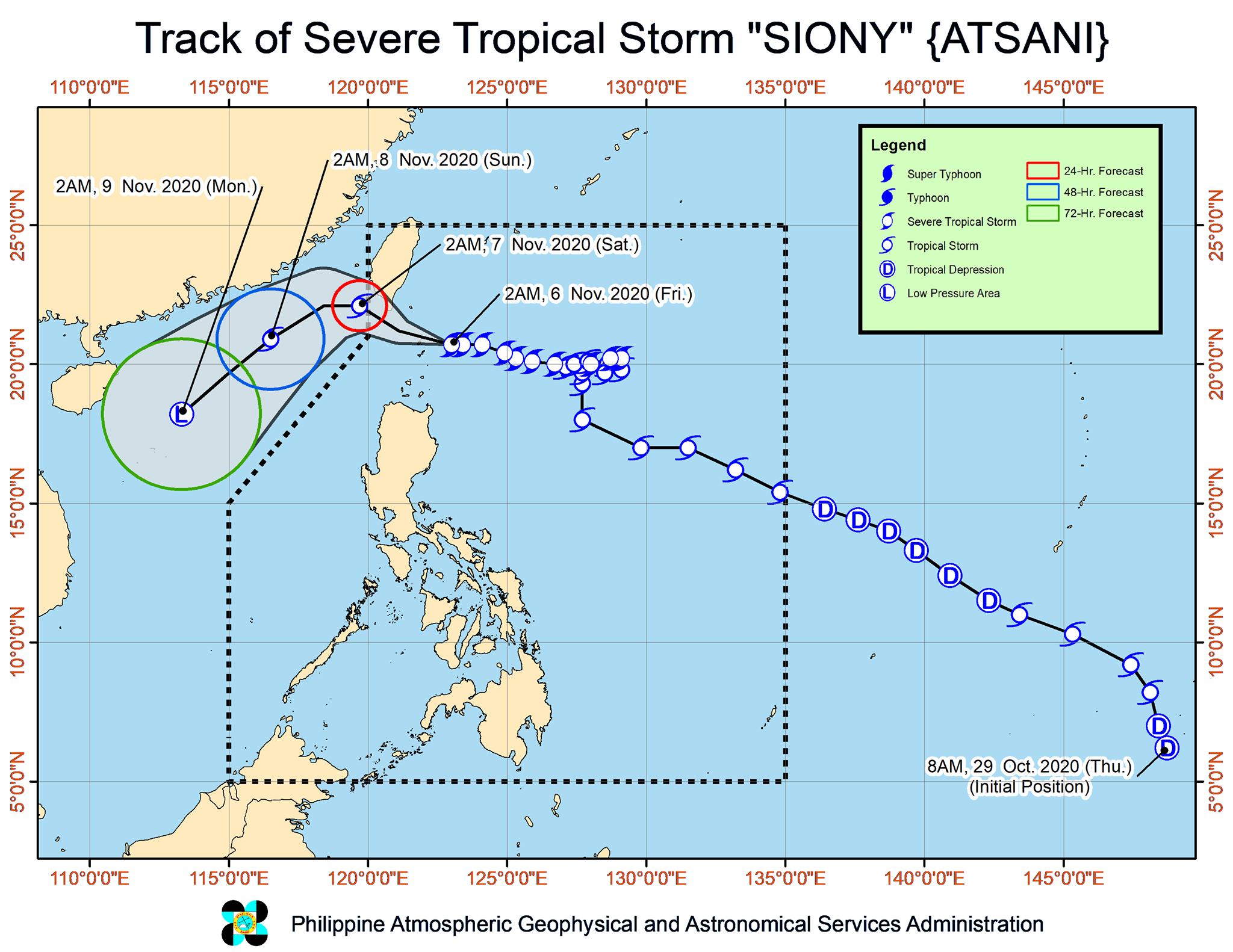
Track and intensity outlook:
• Track: “SIONY” is forecast to make landfall or close approach over Batanes (more likely in the vicinity of Itbayat Island) within the next 2 to 3 hours as it continues to move west-northwestward. It is forecast to exit the Philippine Area of Responsibility (PAR) tonight. It will then turn southwestward tomorrow morning over the sea to the southwest of Taiwan and move over the West Philippine Sea towards the Paracel Islands area.
• Intensity: “SIONY” is forecast to either maintain its current strength or slightly intensify to 100 km/h within the next 24 hours. Beyond this 24-hour window, the storm is forecast to significantly weaken due to increasingly unfavorable conditions associated with a surge of the northeasterlies over the West Philippine Sea. It may be downgraded to a Low Pressure Area on Monday.
Location of eye/center: At 4:00 AM today, the center of Severe Tropical Storm “SIONY” was estimated based on all available data at 60 km East Northeast of Basco, Batanes or 70 km East of Itbayat, Batanes (20.7°N, 122.5°E).
Strength: Maximum sustained winds of 95 km/h near the center and gustiness of up to 115 km/h.
Movement: Moving Westward at 20 km/h.
Forecast Positions
• 24 Hour (Tomorrow morning): 265 km West Northwest of Itbayat, Batanes (OUTSIDE PAR) (22.1°N, 119.7°E)
• 48 Hour (Sunday morning): 570 km West of Basco, Batanes (OUTSIDE PAR) (20.9°N, 116.5°E)
• 72 Hour (Monday morning): 770 km West of Laoag City, Ilocos Norte (OUTSIDE PAR) (18.2°N, 113.3°E)
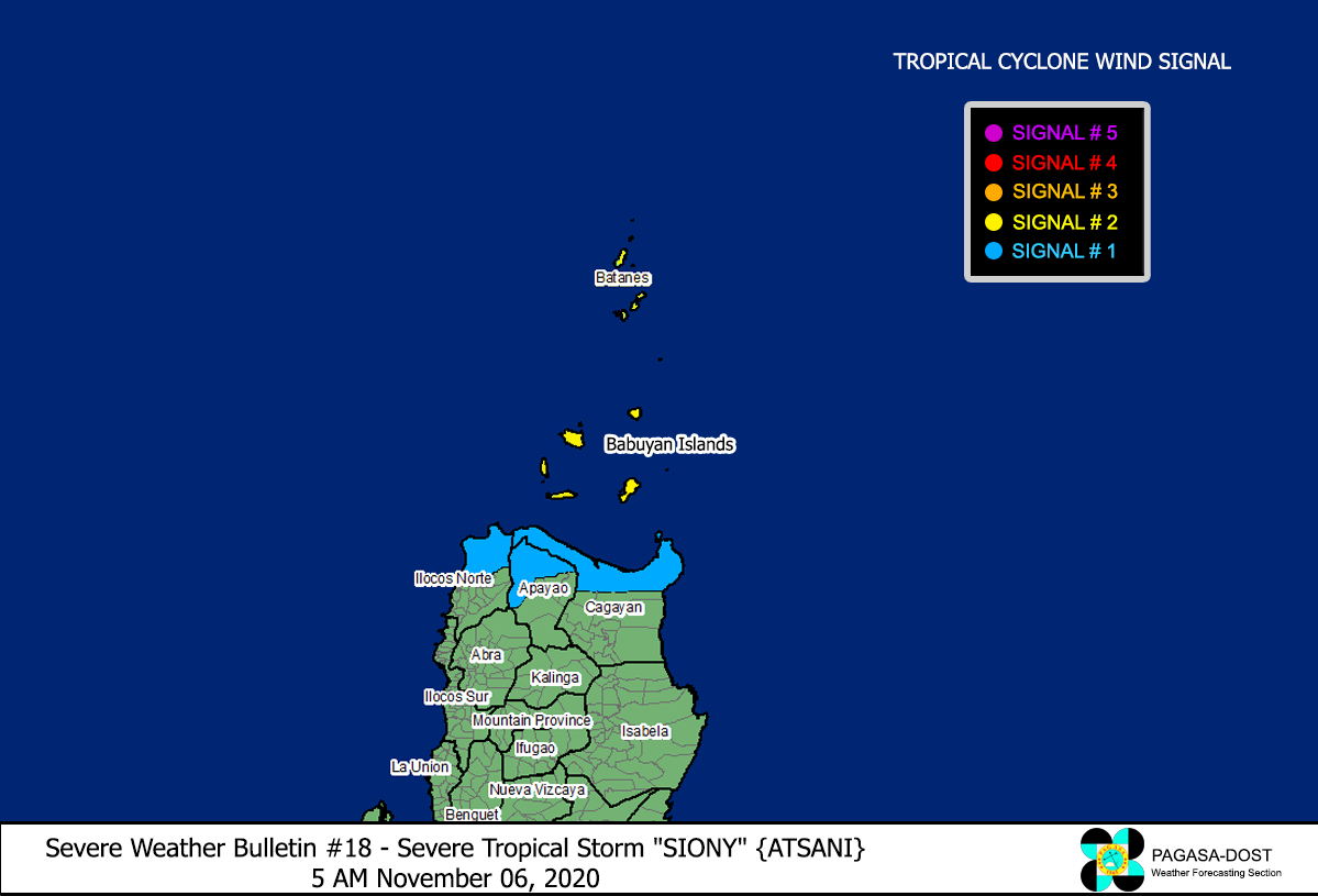
TROPICAL CYCLONE WIND SIGNAL
TCWS #2 (61-120 km/h winds prevailing or expected in 24 hours)
Luzon:
Batanes and Babuyan Islands
TCWS #1 (30-60 km/h winds prevailing or expected in 36 hours)
Luzon:
The northern portion of mainland Cagayan (Santa Ana, Gonzaga, Lal-Lo, Allacapan, Santa Teresita, Buguey, Camalaniugan, Aparri, Ballesteros, Abulug, Pamplona, Sanchez-Mira, Claveria, Santa Praxedes),
The northern portion of Apayao (Santa Marcela, Luna, Calanasan),
The northern portion of Ilocos Norte (Adams, Pagudpud, Bangui, Dumalneg, Burgos, Vintar, Pasuquin, Bacarra)
Other tropical systems being monitored (as of 4:00 AM today)
• The Low Pressure Area outside the PAR was estimated at 1,515 km East of Mindanao (10.1°N,139.3°E). It is forecast to move generally west-northwestward or northwestward and may enter the PAR this afternoon or evening. It is heading towards the direction of Eastern Visayas and may likely reach the area tomorrow afternoon or evening. This weather disturbance may develop into Tropical Depression “TONYO” within the next 48 to 72 hours.