SEVERE WEATHER BULLETIN #3
FOR: TROPICAL STORM “#SionyPH” (ATSANI)
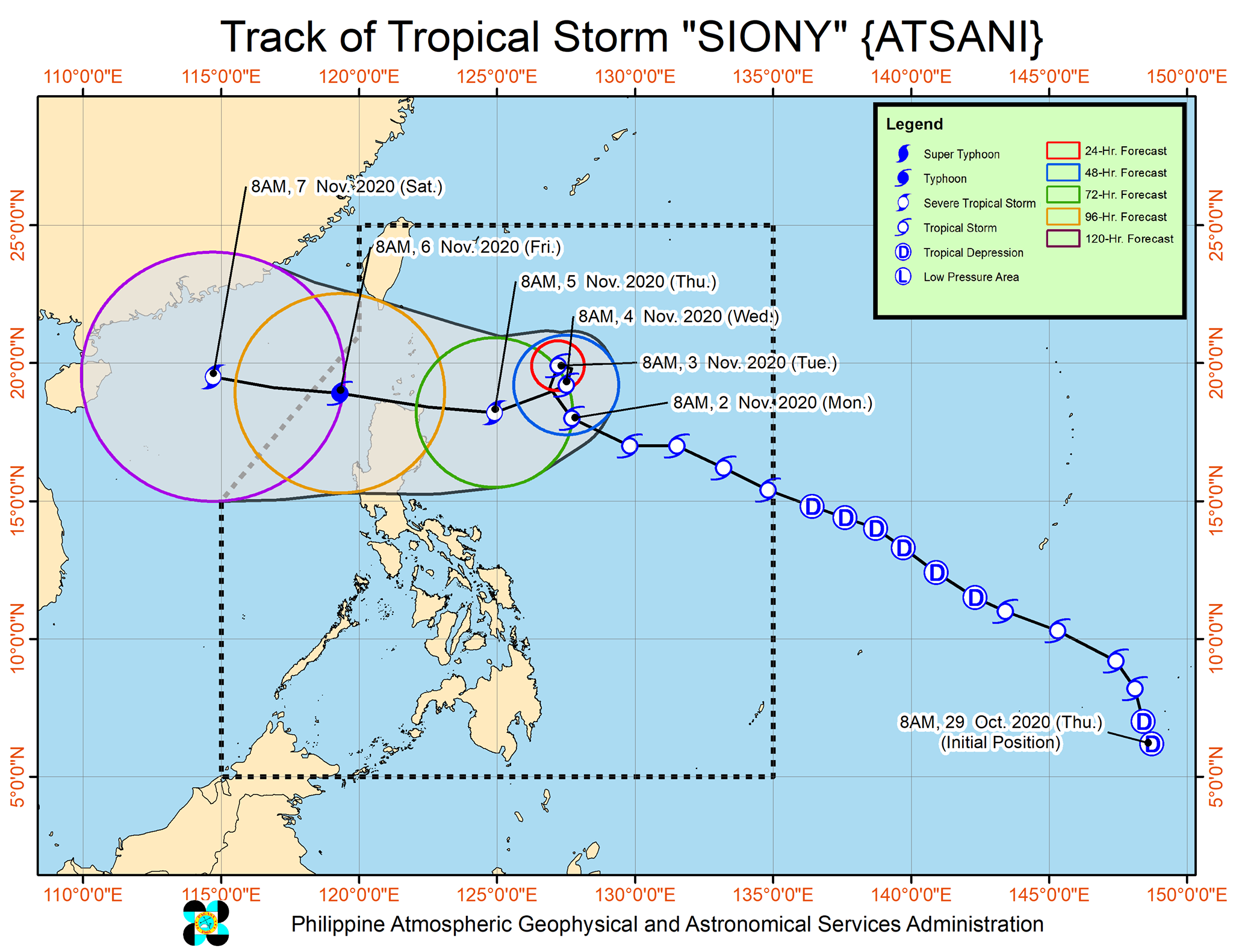
ISSUED AT 11:00 AM, 02 November 2020
TS “SIONY” MAINTAINS ITS STRENGTH AS IT ACCELERATES WEST-NORTHWESTWARD OVER THE PHILIPPINE SEA.
NO TROPICAL CYCLONE WIND SIGNAL
Track and intensity outlook:
• Track: The center of Tropical Storm “SIONY” is forecast to continue moving west-northwestward or northwestward today before it slows down significantly and becomes almost stationary tomorrow morning through Wednesday morning. Afterwards, “SIONY” will begin tracking west-southwestward or westward towards Extreme Northern Luzon. Due to the projected erratic movement of this system in the next 48 hours, there is high degree of uncertainty in the forecast track.
Location of eye/center At 10:00 AM today, the center of Tropical Storm “SIONY” was estimated based on all available data at 620 km East of Aparri, Cagayan(18.1°N, 127.5°E).
Strength Maximum sustained winds of 65 km/h near the center and gustiness of up to 80 km/h.
Movement Moving West Northwestward at 40 km/h.
Forecast Positions
• 24 Hour (Tomorrow morning): 605 km East of Calayan, Cagayan (19.9°N, 127.2°E)
• 48 Hour (Wednesday morning):635 km East of Calayan, Cagayan (19.2°N, 127.5°E)
• 72 Hour (Thursday morning): 345 km East of Aparri, Cagayan (18.2°N, 124.9°E)
• 96 Hour (Friday morning):230 km West of Calayan, Cagayan (18.9°N, 119.3°E)
• 120 Hour (Saturday morning):710 km West of Calayan, Cagayan (OUTSIDE PAR) (19.5°N, 114.7°E)