Update for Tropical Storm “Rolly”
Issued by DOST PAGASA at 11:00 pm, 01 November 2020
“ROLLY” RAPIDLY WEAKENS INTO A TROPICAL STORM.
Track and intensity outlook:
On the forecast track, “ROLLY” is expected to exit the Philippine Area of Responsibility (PAR) on Tuesday morning.
Location of Eye/center
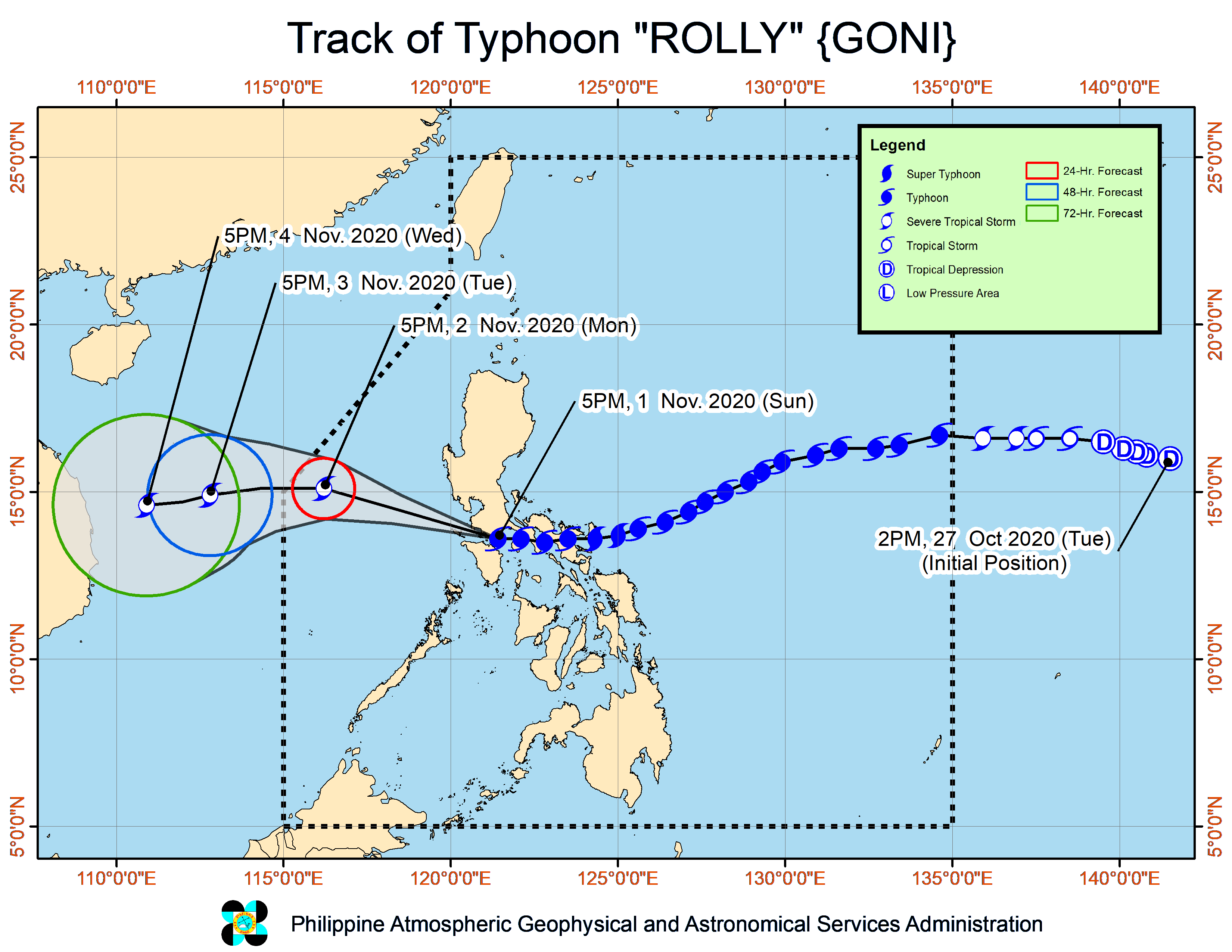
At 10:00 PM today, the center of Tropical Storm “ROLLY” was estimated based on all available data at 150 km Northwest of Calapan City, Oriental Mindoro or 90 km West Southwest of Sangley Pt, Cavite (14.3 °N, 120.1 °E )
Movement
Moving Northwestward at 20 km/h
Strength
Maximum sustained winds of 85 km/h near the center and gustiness of up to 105 km/h
Tropical Cyclone Wind Signals (TCWS)
TCWS# 2:
Luzon
The western portion of Cavite (Naic, Indang, Mendez, Tagaytay City, Amadeo, Ternate, Maragondon, General Emilio Aguinaldo, Magallanes, Alfonso), the western portion of Batangas (Tingloy, Bauan, Mabini, San Luis, Santa Teresita, Taal, San Nicolas, Agoncillo, Laurel, Talisay, Calaca, Lemery, Tuy, Balayan, Nasugbu, Lian, Calatagan), and the northern portion of Occidental Mindoro (Abra de Ilog, Mamburao, Paluan) including Lubang Island
TCWS#1:
Luzon
The central portion of Occidental Mindoro (Sablayan, Santa Cruz), the northern portion of Oriental Mindoro (Victoria, Naujan, Calapan City, Baco, San Teodoro, Puerto Galera), the rest of Batangas, Laguna, the northern and western portion of Quezon (Sampaloc, Lucban, Sariaya, Lucena City, Tayabas City, Dolores, Candelaria, Tiaong, San Antonio, Real, General Nakar, Infanta), the rest of Cavite, Rizal, Metro Manila, Bulacan, Pampanga, Bataan, and the southern portion of Zambales (San Marcelino, San Felipe, San Narciso, San Antonio, Castillejos, Subic, Olongapo City)